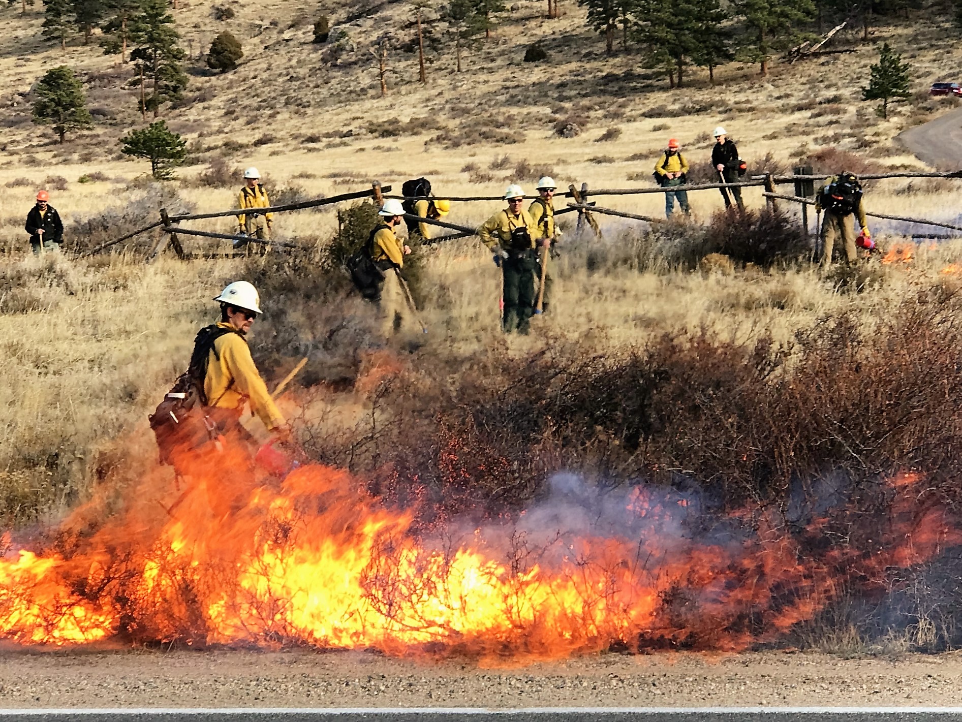
As part of the ongoing hazardous fuels reduction project, the Salida Ranger District will conduct prescribed burns in Chaffee County, beginning in October and continuing through December 2021, conditions permitting.
The Mount Shavano Prescribed Fire project includes burning 434 acres five to seven miles west-northwest of Poncha Springs. The North Trout Creek Prescribed Fire project includes burning 917 acres approximately four miles east of Buena Vista.
Using low-intensity and managed prescribed fire helps promote the health and diversity of different ecosystems,” said Acting Salida District Ranger Destiny Chapman. “Prescribed fire projects help reduce hazardous fuel build up on the landscape, which enhances public and firefighter safety.”
The Mount Shavano Prescribed Fire project is located between Lost Creek (Forest Service Road 219) and North Fork (County Road 240); and near Placer Creek (Forest Service Read 250A) and Droney Gulch. Temporary road closures of Forest Service Roads 250, 250A, and 219 will be necessary during the burns for safety reasons.
The North Trout Creek Prescribed Fire project is located between McGee Gulch and Shields. Starting in early November 2021, temporary road closures of Forest Service Roads 305, 315, and 376 will be necessary during the bums for safety reasons.
To facilitate burning, each of the selected areas have been prepared in advance to ensure safe fire operations. These prescribed burns will help reduce the heavy fuel loading that poses a safety threat to the recreating public and firefighters suppressing wildfires in the area.
Ignitions will occur only when weather and fuel conditions meet established parameters and when smoke impacts can be managed within established requirements. Ignition and burning operations may continue for several days depending on the size of area being burned. Fire personnel will monitor the burns until the fires are completely out.
Smoke is a natural byproduct of fire and some amounts are unavoidable. However, fire managers and prescribed fire specialists look carefully at the proximity of communities and determine the least amount of smoke impact to the public during prescribed burning. Expect smoke to be visible throughout the Arkansas River Valley and Park County once the bums begin. Smoke may also linger over the burn areas for a few days following initial ignitions.
For more information on smoke, please visit: colorado.gov/pacifie/edphe/wood-smoke-and-health
For more fire resources, including notification of when burns will take place, please visit the fire management page at: fs.usda.gov/main/psicc/fire


